|
<< Click to Display Table of Contents >> Annotate elevations |
  
|
|
<< Click to Display Table of Contents >> Annotate elevations |
|
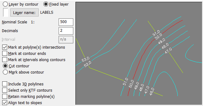
Purpose
To annotate contour elevations with a number of presentation options.
Operation
Choose presentation option – for typical use as shown the locating 2D Polylines need to be drawn first to fix intersection positions.
Include 3D Polylines
Will also recognise 3D Polylines
Select only KTF contours
To only work with contours drawn from KTF ground model
Retain marking polyline(s)
Toggle "on" if want to leave the 2D polylines marking the annotation locations in drawing (yellow lines in above screen grab)
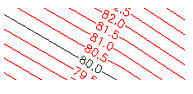
Align text to slopes
Toggle "on" and the annotation text will facing uphill slopes. See image below.

"Align to slopes" effect: Left side setting "on", right side "off".