|
<< Click to Display Table of Contents >> Cross Sections from 3D Polylines |
  
|
|
<< Click to Display Table of Contents >> Cross Sections from 3D Polylines |
|
Purpose
To create cross sections at right angles to a defining 2D or 3D Polyline crossing 3D Polylines representing channels, kerbs and verges etc. The defining Polyline may be representing a proposed horizontal alignment, existing road centre line or centre of a river for example. This method is highly suitable for creating existing road and river cross sections. Chainage direction is set by the direction of the 2D or 3D Polyline - use menu item Polyline utilities, Reverse direction to confirm and reverse if required.

3D Polylines representing centre in cyan, channels in yellow, kerbs in red and back of footpath in white.
Operation
Pick the 2D or 3D Polyline representing the "centre-line" in typical use and shown in cyan above. Return to accept default of not using 2D Polylines or enter "Y" if these are to be included (they must have a suitable elevation). Select the 3D Polylines and enter the output file name.

Settings for typical use looking left and right up to 10 metres each side
Road Name:
Will appear if set in Design, Horizontal, Extract geometry
Interval
Regular chainage interval to locate cross sections.
Left Offset
Extent to the left (negative for typical use).
Right Offset
Extent to the right (positive for typical use).
Chainage at start of Polyline
0.000 for typical use but may be set by Design, Horizontal, Extract geometry.
Start Chainage
Chainage to locate first section.
End Chainage
Chainage to locate end chainage.
Special Chainages
May be added by hand or "Input" from .lsc file to locate additional sections.
Chainage marking
To provide cross section chainage labels and markers.
Draw as 3D Polylines
To draw cross sections as 3D Polylines in plan.
Output files
Setting out (.sot)
CHAINAGE 10.000 BEARING 93°1'47"
point Easting Northing Level Offset String Name
1 1944.918 1440.663 34.418 -6.314 JAAE
2 1944.790 1438.238 34.562 -3.885 K00A
3 1944.777 1437.997 34.494 -3.643 C00F
4 1944.584 1434.359 34.589 0.000 M001
5 1944.390 1430.694 34.667 3.670 C00E
6 1944.379 1430.474 34.767 3.890 K009
7 1944.227 1427.604 34.516 6.764 JAAA
Railway (.rwy)
0.000 1934.203 1428.410 34.397 6.545 JAAA
10.000 1944.918 1440.663 34.418 -6.314 JAAE
10.000 1944.790 1438.238 34.562 -3.885 K00A
10.000 1944.777 1437.997 34.494 -3.643 C00F
10.000 1944.584 1434.359 34.589 -0.000 M001
10.000 1944.390 1430.694 34.667 3.670 C00E
10.000 1944.379 1430.474 34.767 3.890 K009
10.000 1944.227 1427.604 34.516 6.764 JAAA
20.000 1954.907 1440.182 34.540 -6.361 JAAE
CSV
10.000,-6.314,34.418,1944.918,1440.663
10.000,-3.885,34.562,1944.790,1438.238
10.000,-3.643,34.494,1944.777,1437.997
10.000,-0.000,34.589,1944.584,1434.359
10.000,3.670,34.667,1944.390,1430.694
10.000,3.890,34.767,1944.379,1430.474
10.000,6.764,34.516,1944.227,1427.604
20.000,-6.361,34.540,1954.907,1440.182
Hec-Ras and ISIS are River section formats referred to in Sequence 7.
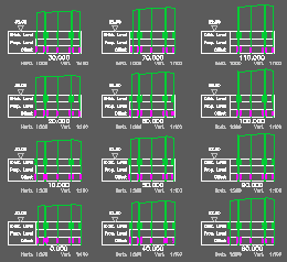
To draw the cross sections use menu item Sections, Draw Cross Sections.